Delhi-NCR Rain: Severe Waterlogging and NH-48 Collapse Trigger Massive Commuter Chaos

The National Capital Region (NCR) was thrown into severe logistical chaos during the early hours of Thursday, July 9, 2026, as an unrelenting spell of monsoon rain battered Delhi and its neighbouring satellite cities. While the torrential downpours offered a welcome and much-needed respite from the oppressive summer humidity that had plagued the region over the preceding days, the sheer volume of water quickly overwhelmed local infrastructure.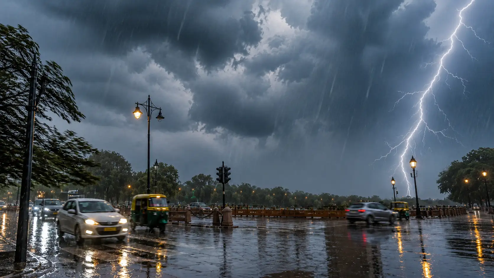
The India Meteorological Department (IMD) promptly issued an elevated alert for the capital, warning citizens of widespread disruption, severe waterlogging, and treacherous travel conditions. The intense weather system is driven by a moving low-pressure area embedded tightly within the monsoon trough, creating a heavy cloud cover that has consistently penalised the region with sudden, violent cloudbursts.
The impact on morning commuters across the region was immediate and severe, with key arterial routes heavily waterlogged. Flooding was reported from prominent locations including the vicinity of the New Delhi Railway Station, Munirka, Pitampura, and part of North Delhi such as Jahangirpuri. Vehicles were seen navigating through knee-deep water, causing major traffic backlogs that stretched for several kilometres.
To compound the distress, local authorities reported incidents of uprooted trees blocking critical thoroughfares, including an incident outside the National Heart Institute Hospital in East of Kailash, which required emergency municipal teams to clear the debris. On the outskirts, Gurugram bore an exceptionally heavy brunt of the monsoon's fury, registering roughly 115 millimetres of rainfall over a 48-hour period. This intense saturation caused a significant section of National Highway 48 (NH-48) to cave in near the Narsinghpur area, completely disrupting the Delhi-Jaipur highway traffic and forcing traffic police to issue urgent advisories.
According to precise cumulative data gathered by meteorologists, the rainfall distribution exhibited remarkable variation across different monitoring stations within the NCR. Within Delhi proper, Mehrauli recorded the highest level at 83 millimetres, closely followed by Lodi Road at 79 millimetres and Pusa at 73 millimetres.
Meanwhile, the neighbouring district of Ghaziabad experienced some of the highest precipitation across the entire metropolitan area, with Kamla Nehru Nagar recording a staggering 143 millimetres of rain. Independent weather experts and amateur meteorologists have categorised this as a massive, high-impact weather event, noting that the region's position in the western quadrant of the low-pressure system means the most crucial periods of intense downpours remain a threat.
Residents have been strongly advised to stay indoors unless travelling is absolutely essential, as the drainage systems in East Delhi, Noida and Greater Noida struggle to cope with the influx.
Looking ahead, the meteorological forecast indicates that the regional disruption is unlikely to subside immediately. The IMD predicts that fairly widespread to widespread rainfall, accompanied by intense thunderstorms, lightning, and gusty winds reaching speeds of up to 50 kilometres per hour, will persist across Delhi, Haryana, and Western Uttar Pradesh. Although temperatures have dropped comfortably to a maximum of around 27 degrees Celsius, providing immediate thermal relief, the risk of structural hazards remains exceptionally high.
Civic bodies and disaster management teams have been deployed at multiple flashpoints to pump out stagnant water and regulate traffic. Residents are urged to remain highly vigilant, particularly around old or under-construction buildings, as a tragic building collapse was already reported in Delhi's Rohini district during the peak of the storm, underscoring the severe dangers associated with this relentless monsoon spell.
The India Meteorological Department (IMD) promptly issued an elevated alert for the capital, warning citizens of widespread disruption, severe waterlogging, and treacherous travel conditions. The intense weather system is driven by a moving low-pressure area embedded tightly within the monsoon trough, creating a heavy cloud cover that has consistently penalised the region with sudden, violent cloudbursts.
The impact on morning commuters across the region was immediate and severe, with key arterial routes heavily waterlogged. Flooding was reported from prominent locations including the vicinity of the New Delhi Railway Station, Munirka, Pitampura, and part of North Delhi such as Jahangirpuri. Vehicles were seen navigating through knee-deep water, causing major traffic backlogs that stretched for several kilometres.
You may also like
- After NEET, allegations of paper leak in UGC-NET exam
- Indian Army moves ahead with ₹1500cr loitering munitions purchase
- Watch: Heavy rains wreak havoc as Monsoon covers entire India; videos capture water logging, traffic jams & destruction
- Jammu and Kashmir opens Salal Dam gates, Pakistan on alert
- Monsoon rains July 8-9 flood Indian cities as IMD warns
To compound the distress, local authorities reported incidents of uprooted trees blocking critical thoroughfares, including an incident outside the National Heart Institute Hospital in East of Kailash, which required emergency municipal teams to clear the debris. On the outskirts, Gurugram bore an exceptionally heavy brunt of the monsoon's fury, registering roughly 115 millimetres of rainfall over a 48-hour period. This intense saturation caused a significant section of National Highway 48 (NH-48) to cave in near the Narsinghpur area, completely disrupting the Delhi-Jaipur highway traffic and forcing traffic police to issue urgent advisories.
According to precise cumulative data gathered by meteorologists, the rainfall distribution exhibited remarkable variation across different monitoring stations within the NCR. Within Delhi proper, Mehrauli recorded the highest level at 83 millimetres, closely followed by Lodi Road at 79 millimetres and Pusa at 73 millimetres.
Meanwhile, the neighbouring district of Ghaziabad experienced some of the highest precipitation across the entire metropolitan area, with Kamla Nehru Nagar recording a staggering 143 millimetres of rain. Independent weather experts and amateur meteorologists have categorised this as a massive, high-impact weather event, noting that the region's position in the western quadrant of the low-pressure system means the most crucial periods of intense downpours remain a threat.
Residents have been strongly advised to stay indoors unless travelling is absolutely essential, as the drainage systems in East Delhi, Noida and Greater Noida struggle to cope with the influx.
Looking ahead, the meteorological forecast indicates that the regional disruption is unlikely to subside immediately. The IMD predicts that fairly widespread to widespread rainfall, accompanied by intense thunderstorms, lightning, and gusty winds reaching speeds of up to 50 kilometres per hour, will persist across Delhi, Haryana, and Western Uttar Pradesh. Although temperatures have dropped comfortably to a maximum of around 27 degrees Celsius, providing immediate thermal relief, the risk of structural hazards remains exceptionally high.
Civic bodies and disaster management teams have been deployed at multiple flashpoints to pump out stagnant water and regulate traffic. Residents are urged to remain highly vigilant, particularly around old or under-construction buildings, as a tragic building collapse was already reported in Delhi's Rohini district during the peak of the storm, underscoring the severe dangers associated with this relentless monsoon spell.






Loving Newspoint? Download the app now